The Arizona Trail on Unicycle: Day 7: Mexican Food for Dinner
April 6, 2017
As you may recall, we camped in a wash about two miles up from the river. A solid ten mile hike straight up hill awaited us and I it was nice to cut off a few miles in the morning as the previous days hike was pretty grueling in the hot sun.
Our plan was to get up at about 5am to get an early start at about 6:30. I was out of oatmeal and had some Ramen style noodles for breakfast instead. The salt tasted great and it was nice and filling.
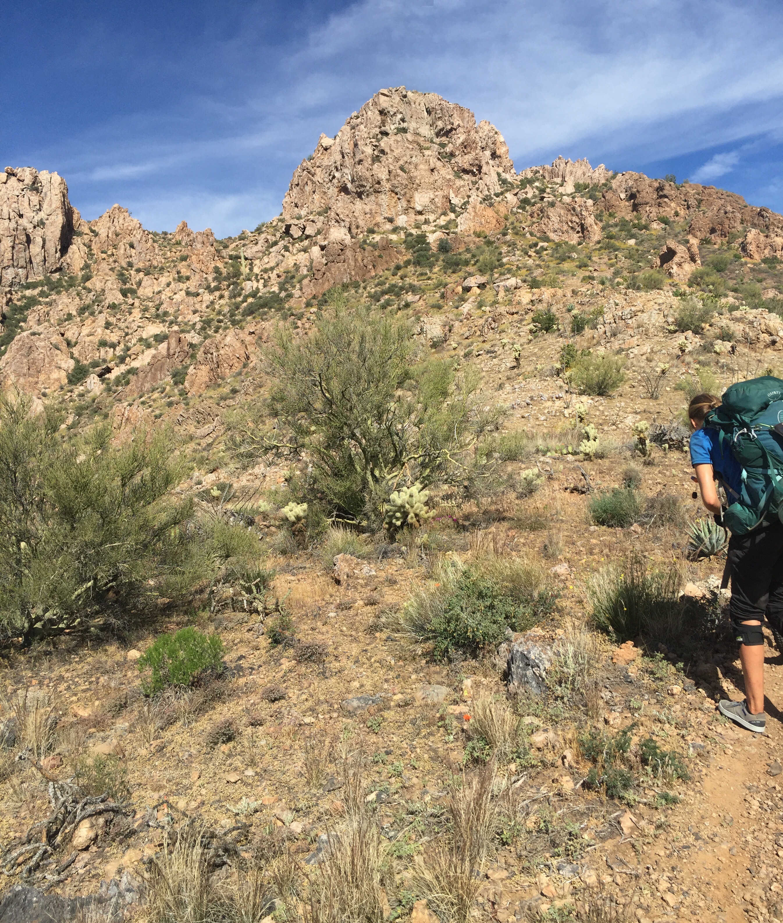
The plan went dead on the money and Rebekka and I headed out at 6:30. Jamey had camped down the trail a half mile back to get the more amazing views, and he was going to just catch up to us at some point. I drew a little unicycle in the sand with a small arrow to let Jamey know that we headed off. The views on the hike up were amazing. Red and golden cliff edges kissed by the morning sun.
We had a large hill to hike but it wasn’t too bad in the cooler morning. Eventuallly Jamey caught up and we continued up the hill.
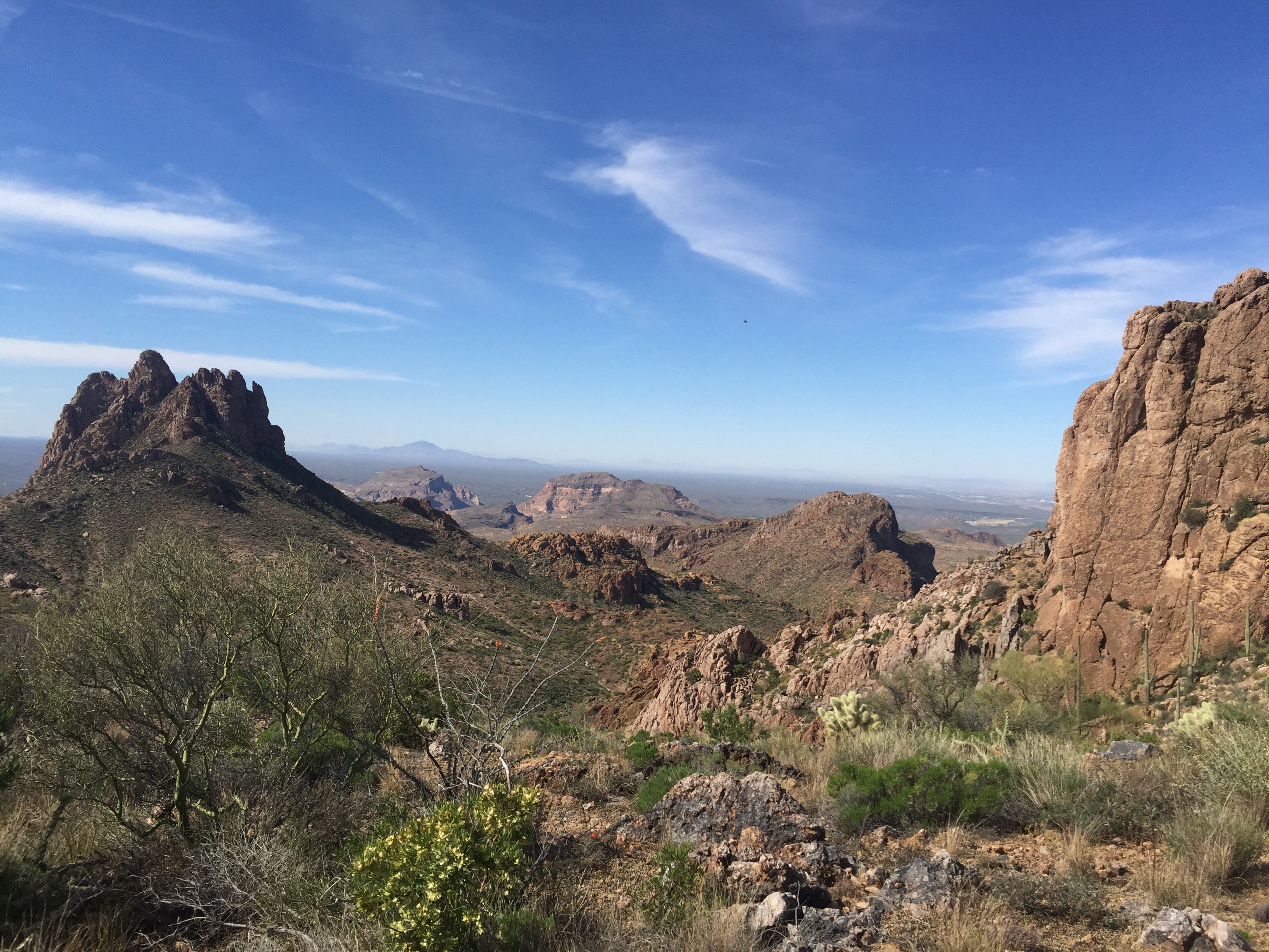
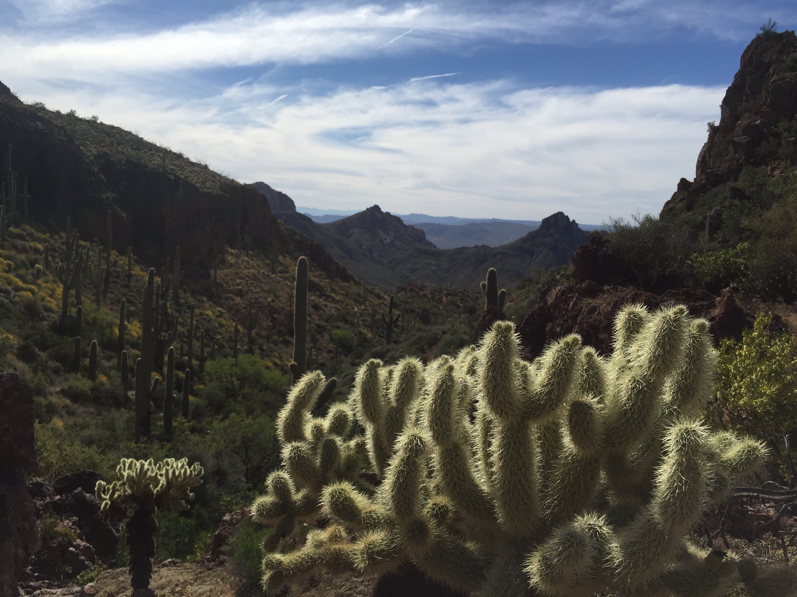
Our plan was to hike about 7 miles to the top of the mountain and get more water. It took way longer than we expected and it was tricky to locate the dirt water hole used for livestock. We did manage to ride a bit of the downhill but it was touch and go. Becky found the water spot and it was quite a bit brown looking, but we filtered it out. Unfortunately it proved too much for my water pump, and all the cleaning I did wasn’t working to make it better. So, I ended up using Jamey’s squeeze filter to get a little water and tossed my pump in the trash the next day.
We left the water and did some more riding down. The trail was supposed to be an easy green/blue trail for mountain bikers, but it proved to be slow and tough for us. I started to get quite a bit tired and was lagging behind the others and walking more and more bits that I normally would have ridden.
We finally hit the trail head and parking lot. The goal was to make it to the town of Superior to get our resupply packages, but the post office closed around 5 and it was probably around 4pm at that point. We pushed/road a track over to the highway and decided we would take the road into town instead of a harder trail. Jamey was set on trying to hitch hike the 4 or 5 miles to town so we started to hang out on this huge two lane road trying to hitch a ride. I doubted that all three of us would be able to get a ride, and after about 10 or 15 minutes I decided to just ride into town. Rebekka came with me but Jamey stayed behind.
We got about a mile or so from the town of Superior and see Jamey sticking his head out from a car yelling at us that he’ll be at the hotel. As we kept riding I would stick my thumb out. Finally a truck pulled over with two nice ladies and a smaller girl. We tossed our unicycles in their truck and hopped in the back of the cab and were off! The woman said she could take us wherever we needed to go, so I had her drive us to the post office in the off chance it was still open. It wasn’t, so she kindly took us to the hotel Jamey was going to.
We saw Jamey outside and he said, “Do you want the good news or the bad news?” The bad news: no hotel rooms, which wasn’t too big a deal to me as I hadn’t been on the trail as long as the others. It was also the only hotel in Superior. The good news: the owner said we could camp in her yard and use their personal shower. Awesome! People can be so kind and it gives me faith in humanity to see people like that.
So, I flipped an old rug upside down to protect my tent from rocks. It turns out the rug was out there because it reeked of dog, but my tent’s footprint kept the stink out. We all took showers: I took a really quick one just to not overstay our welcome.
We then headed off and got some Mexican food for dinner at a nearby restaurant. It was delicious compared to what I had been regularly eating. The one bad thing: they didn’t serve beer! So Jamey and I walked a little further down and grabbed a few drinks before going back to the tents and snoozing.
Stats:
Today: ~40 miles
Total: 187.9 miles
Route:
My Strava track got messed up and was cut short that day, so the route below is another GPX file that I thought was pretty close. It added a few more miles on, but we also rode a few miles further on the road, so it probably evened out.
Strava: https://www.strava.com/activities/931295929 // Cut short!! It wasn’t 4.5 miles. Strava glitched.


This Is Awesome Man! Thanks for documenting your travels! I have been muni’n and didn’t know you could unipack! I am so into it. Btw, impressive distances, I am still at 10ish mile short rides around the trails, you are inspiring me to get out there!
Cool, glad you enjoyed it! Definitely keep up with it…it gets easier and easier.